the john muir exhibit - john_muir_national_historic_site - directions
John Muir National Historic Site
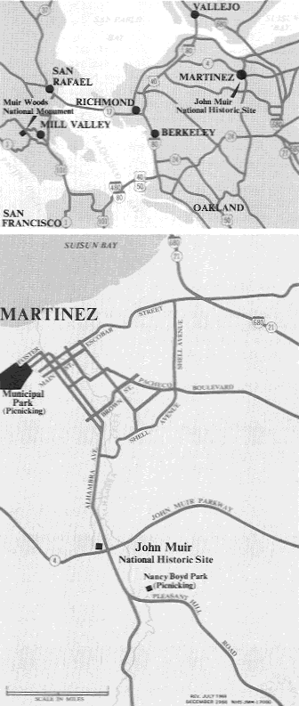
Map and Driving Directions
By Automobile

From San Francisco/Oakland
:
Take Interstate 80 north, Calif. Hwy 4 East,
EXIT Alhambra Avenue north to Martinez, or Calif. Highway 24 east to 680 north, Calif. Hwy 4 West, EXIT at Alhambra and
turn left at bottom of the ramp. Cross beneath the freeway and railroad tracks. The visitor center parking lot will be immediately on the left hand side.
From Sacramento
:
Take Interstate 80 West, Calif. Hwy 4 West, EXIT Alhambra Avenue to Martinez. Turn right at the bottom of the ramp. The visitor center parking lot will be immediately on your left.
Public Transportation
Amtrak
: Daily rail service to downtown Martinez from most areas of
the U.S. (800) 872-7245.
Bus Service
:
Contra Costa County Transit ((925) 676-7500), Line #116, provides access to the Site with connections to AMTRAK, the Pleasant Hill BART station and the Walnut Creek BART station. For connections from BART to
Martinez, call (925) 465-2278.
Nearest Airports
: Oakland International (32 miles); San Francisco
International (50 miles).
Return to John Muir National Historic Site Home Page
Home
| Alphabetical Index
| What's New & About this Site