the john muir exhibit - writings - the yosemite
The Yosemite
by
John Muir
Contents
-
The Approach to the Valley
-
Winter Storms and Spring Floods
-
Snow-storms
-
Snow Banners
-
The Trees of the Valley
-
The Forest Trees in General
-
The Big Trees
-
The Flowers
-
The Birds
-
The South Dome
-
The Ancient Yosemite Glaciers: How the Valley Was Formed
-
How Best to Spend One's Yosemite Time
-
Early History of the Valley
-
Lamon
-
Galen Clark
-
Hetch Hetchy Valley
-
Appendix: Legislation About the Yosemite
-
Appendix: Table of Distances
-
Appendix: Maximum Rates for Transportation
List of Illustrations
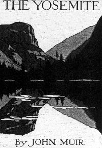
- [Original Cover]
- Yosemite Fall
- Administrative Map of Yosemite National Park
- Yosemite Valley from Artist's Point
- Cathedral Rocks and Cathedral Spires as seen across Merced River
- Vernal Fall
- Nevada Fall--Side View
- Vernal Fall
- Yosemite Valley in a Snowstorm
- The Three Brothers
- Looking down Yosemite from the Slope of Clouds' Rest
- Looking up Tenaya Cañon from Glacier Point--Mt. Hoffman,
covered with snow, to the left
- The Mariposa Grove
- Fern Gardens and Oak Groves of Hetch-Hetchy Valley
[Photographed by J. W. Le Conte.]
- Sentinel Rock, from the Glacier Point Trail
- North Dome--Royal Arches--Washington Column--Merced River
- Mirror Lake, Mt. Watkins and Slopes of Clouds' Rest
- The Half Dome, Clouds' Rest Beyond
- The Three Brothers--the left-hand one, Eagle Peak, is the highest
- Looking down the Valley from the Glacier Point Trail
Sentinel Rock Cathedral Rocks El Capitan
- Looking up Tenaya Cañon from the Trail to Glacier Point
- Echo Peaks on the trail from the Yosemite Valley to the
Tuolumne Meadows
- Slope of Mt. Dana and Lake Tioga, Tuolumne Meadows
- El Capitan
- One of the Great Cascades with water whirls--near the
upper end of Tuolumne Cañon
[Photographed by W. L. Huber.]
- Gem Lake near Mt. Ritter
- Looking up Hetch-Hetchy Valley from Surprise Point
[Photographed by Taber, San Francisco.]
- A River View across the lower end of Tuolumne Meadows
[Photographed by George R. King.]
-
Travel-Guide Map of the Yosemite Valley [172K]
-
Travel-Guide Map of the Yosemite National Park [240K]
- Mt. Lyell and Glacier
- The Park-like floor of Hetch-Hetchy Valley
- The Mariposa Grove
- Hetch-Hetchy Valley
- Tueeulala and Wapama Falls, Hetch-Hetchy Valley
- View of the Hetch-Hetchy Valley
[Except in a few instances, photographs for the above
illustrations were furnished by The Pillsbury Picture Co.]
The Yosemite
By John Muir
New York
The Century Co.
MCMXII
Copyright, 1912, by
The Century Co.
Affectionately dedicated
to my friend,
Robert Underwood Johnson,
faithful
lover and defender
of our glorious forests
and originator of
the Yosemite National Park.
Acknowledgment
On the early history of Yosemite the writer is indebted to Prof. J. D. Whitney
for quotations from his volume entitled
Yosemite Guide-Book
,
and to Dr. Bunnell for extracts from his interesting volume entitled
Discovery of the Yosemite
.
Bibliographic Information
The Yosemite.
Muir, John,
1838-1914.
Originally published: New York: The Century Company, 1912.
Call number: F868 .Y6 979-4'47
Book scanned and converted to HTML by Dan Anderson,
1996. Text corrected by Andrew Sly 2003. Additional links and HTML updated by Harold Wood, 2003. Under current U.S. copyright law, this book is in the public domain.
Writings of John Muir
Home
| Alphabetical Index
| What's New & About this Site