sierraclub.org - sierra magazine - july/august 2010 - north star 2.0


North Star 2.0
I once was lost but now am (digitally) found
Advances in technology only make it seem like the world is getting smaller. There's still a lot of wilderness out there to get lost in, and we could all use some help now and then getting from trailhead A to campsite B. These tools—from cutting-edge to time-tested—will help keep you on the right path. —Steve Casimiro
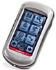 GARMIN OREGON 550T You can't navigate by GPS if you can't navigate your GPS's menu. Of all the major devices tested, Garmin's touch-screen Oregon 550t shines as the simplest to use, with intuitive maps and powerful features such as a camera, which allows you to remember breakfast spots and swimming holes by photo, not just lat-long. $600; garmin.com
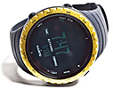 SUNNTO CORE Among the most stylish of the "ABC watches"—altimeter, barometer, compass—the Suunto Core adds a thermometer, an altitude-tracking log, and a depth meter. It's doubtful that many buyers will take it to its upper limit of 29,500 feet, but in testing between 15 feet underwater and 10,000 feet above sea level, it proved accurate and reliable. Starting at $275; suunto.com
 BRUNTON ECLIPSE 8099 Brunton's mirrored compass does a lot more than point north. It works anywhere in the world (not all compasses do), measures a slope's angle or a trail's incline, deciphers maps, and calculates a cliff's height. Instructions are handily tucked into the base plate. $95; brunton.com
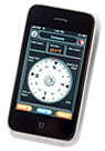 MOTIONX-GPS IPHONE APP Any reluctance you have about taking your iPhone into the backcountry should disappear after using MotionX's full-featured GPS app. It's ridiculously cheap and rivals any stand-alone device for helping you get where you want to go. Even at high noon, the screen is bright and easily read, whether you're following a route you've downloaded or creating your own. $3; motionx.com
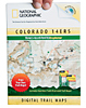 TRAILS ILLUSTRATED EXPLORER Google Earth is fun for inspiration, but for utility it has nothing on National Geographic's mapping software. Trails Illustrated Explorer lets you peruse beautifully drawn topos at four levels of detail, then mark routes and key spots to transfer to a GPS for navigating in the field. The Mac- and PC-compatible program even displays rudimentary information when you (virtually) hover over a trail. $25 per regional series; trailsillustrated.com
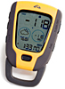 HIGHGEAR TERRAPOD The skies were clear and blue as far as the eye could see, but this mini weather station predicted rain. Sure enough, within eight hours, the drops were falling, and the 2.6-ounce barometer-altimeter had won a convert for its accurate analysis of dropping air pressure. $70; highgear.com
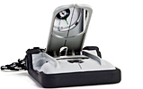
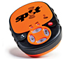 SPOT SATELLITE GPS MESSENGER Think of Spot's apparatus as life insurance: It lets you call for help (or just keep in touch) even when miles from the nearest cellular signal. The 5.2-ounce gadget connects via satellite to a worldwide emergency-response network so you can holler for rescue—or brag to friends (via e-mail or text) about that 20-inch rainbow trout you just landed. $170; findmespot.com
 BUSHNELL BACKTRACK Leery of technology? Bushnell's puck-size device is for you. It marks a single spot—a trailhead, for example—and guides you back to it with a no-frills display of distance and direction. $85; bushnell.com
Photos by Lori Eanes (8)